The digitization of mobile sites in telecommunications through drones, scanners, and 3D cameras is revolutionizing the way mobile network infrastructure is managed, inspected, and expanded. The use of this technology adds value in terms of efficiency, cost savings, security, precision and ease of integration into the company’s processes, also allowing a qualitative leap in the management of deployment projects and in the maintenance of mobile sites.
Drones are unmanned aerial systems equipped with advanced sensors such as LiDAR, photogrammetry, RGB and thermal cameras, GPS, and RTK. These devices make it possible to capture accurate three-dimensional representations of physical infrastructures, such as mobile sites, using aerial scanning techniques. Its main application in telecommunications is the generation of digital twins.
On the other hand, 3D scanners are ground-based devices, usually fixed, that also incorporate high-precision sensors to capture the complete geometry of infrastructures in the form of three-dimensional point clouds. These scans are complemented by cameras that allow detailed photogrammetric models of the equipment to be obtained, as well as to generate virtual tours through video capture.

Below, we detail the main benefits of this technology:
Operational efficiency and time reduction
Drones and scanners equipped with high-resolution cameras and 3D capture systems make it possible to digitize spaces in much less time than traditional methods. Where before a survey, inspection or photographic documentation could take days or weeks and require the presence of several technicians in the field, today everything can be solved in a matter of hours and without service interruptions.
This streamlining entails improvements such as:
- Faster deployment and commissioning of new infrastructure.
- Ability to carry out recurrent inspections and topographic surveys to monitor works and evolution of facilities.
- Cost reduction and resource optimization
By eliminating the need for large field equipment, lifting cranes, or manual access to elevated and hazardous areas, drones, scanners, and 3D cameras contribute to significantly reducing costs associated with personnel and logistics. In addition, they can work in conditions where other technologies would be limited (e.g. structures that are difficult to access).
Optimization is also reflected in the management and digital storage of all the data collected, integrating drawings, point clouds and downloadable digital models for subsequent analysis, as well as for performing predictive maintenance.
Likewise, this digital information is capable of being processed through tools and applications with built-in artificial intelligence and provide multiple additional use cases that will result in operational improvements, guaranteeing the accuracy of the data in the analyses carried out.
Improved job security
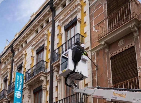
Many mobile infrastructures are located in elevated or hard-to-reach locations, such as telecommunications towers, rooftops, or poles. The use of drones minimises the risk to personnel by avoiding work at height or in dangerous environments, as information collection is carried out remotely and without direct physical contact.
Data accuracy and quality: orthophotos and 3D models
Mounted on drones, the 3D cameras and LiDAR (Light Detection and Ranging) sensors capture high-resolution three-dimensional images and data, generating orthophotos, point clouds and digital models with a level of detail superior to manual methods. This is key for planning, designing, verifying coverage and identifying structural or environmental incidents.
3D models allow precise virtual measurements, evaluation of assembly options and simulation of scenarios from the office, with information faithful to the real site.
In addition, this capture ensures that the physical deployments conform to the intended design and meet the technical requirements for mobile site commissioning.
Another advantage is the real-time monitoring of the progress of works and infrastructures through regular flights and 3D records, which optimizes project management, improves coordination and facilitates updated visual audits.
Ease of integration into digital processes and platforms
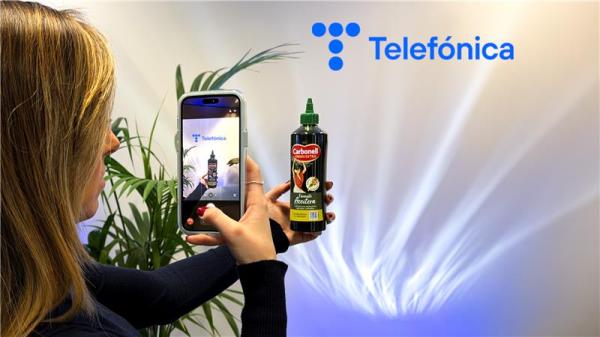
The data obtained by drones, scanners and 3D cameras can be easily integrated into management software tools, BIM (Building Information Modeling) and augmented reality platforms. This facilitates decision-making and the transition to 100% digital management of the mobile infrastructure, even allowing virtual visits or collaborative remote inspections.
The integration of this digital information into the workflows of the design, construction and modification of mobile sites saves time and automates many of the processes inherent in the acceptance of the mobile site.
What is Telefónica doing about it?
Within the innovative spirit and within the framework of transformation in which we are located, Telefónica’s different operations are launching various pilots to validate the incorporation of this type of technology into our processes.
And more specifically, the Telefónica Spain team is carrying out 4 pilots in Barcelona, A Coruña, Lugo and Madrid consisting of carrying out digitization tests of base stations with drones, cameras and 3D scanners. To this end, four companies specialized in this type of technology and a couple of installed companies are participating. In each pilot, several sites have been selected that, due to their characteristics, location or particularities, make them interesting when it comes to identifying the equipment they have.
The aim of the pilots is to assess whether this technology is mature enough to allow detailed digital capture of mobile site information, as well as to verify that the creation and modification of these sites meets design specifications.
Having reliable and accurate information is essential to manage the inventory and maintenance of these assets in an agile and simple way, which also facilitates centralized decision-making and the use of artificial intelligence.
Likewise, the implementation of this technology will allow various improvements to be obtained, such as savings in travel (stakeouts), reduction in execution time and completion of tasks, less need for personnel to undertake on-site actions, the possibility of carrying out virtual inspections and a reduction in CO₂ emissions.
Similar pilots have been carried out from other geographies in Chile and Germany and another is about to begin in Brazil for the digitization of 20 mobile sites.
Conclusions and Challenges
The main conclusions that we highlight in reference to this technology are the following:
- It saves time and resources, substantially reducing inspection time.
- It reduces inspection costs, going from the need for cranes, travel and qualified personnel to the need for only 1 pilot and a drone/scanner for capture.
- It improves worker safety by minimising the risks of working at height.
- Increases data accuracy and quality, moving from variable to centrimetered data accuracy.
- Optimize infrastructure planning, execution, and maintenance, making site reviews and inspections less frequently.
- It facilitates regulatory compliance and complete traceability of each site.
And like any new technology, its implementation involves challenges that must be adequately addressed for its correct implementation:
- Air regulation: it is necessary to comply with local regulations on drone flights, restricted areas and permits (access to the sites and flight).
- Technical training: Operators must be certified and trained in data analysis and the use of this technology.
- Data management: The volume of 3D information requires robust storage and analysis platforms.
- Initial investment: investment in industrial drones, sensors and software is required or choose to outsource as a service to third parties.
At Telefónica we firmly believe that this technology is here to stay and that in the medium term it will be part of the day-to-day work of the technical and operational teams of all telecommunications operators.